ExtremeCloud IQ Site Engine allows you to create geographic and topology maps of devices and floorplans of wireless access points (APs) on your network.
To view maps, you must be a member of an authorization group assigned the OneView > Maps > Maps Read Access or Maps Read/Write Access capability.
Types of Maps
Using ExtremeCloud IQ Site Engine Maps, you can create three types of maps, each presenting a different visual representation of your network:
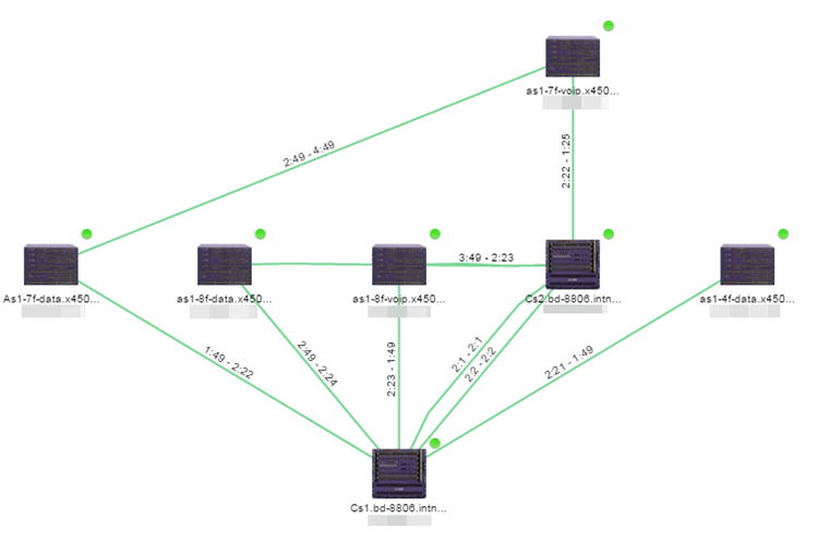
- Topology (default) — A topology map shows how devices are connected in a network, specifically, the state and speed of the network connections between devices as well as the state of the devices in the network. You can also create a topology map with a background image, giving you additional information about the devices and connections that make up the network.
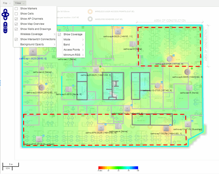
- Floorplan — The floorplan map displays the location of APs in a floorplan you configure. Using information about the size and composition of the building, this map provides an overview of the coverage of wireless APs.
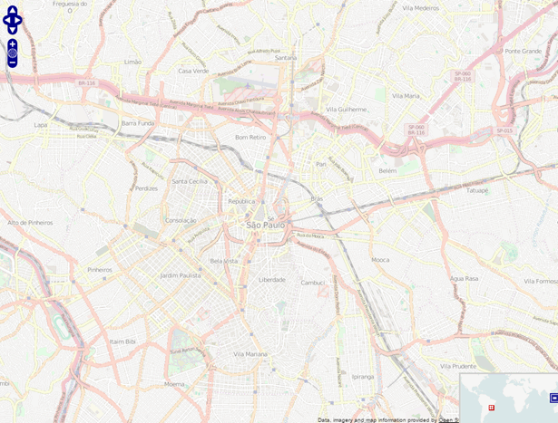
- Geographic — The Geographic map shows a global or regional view where network locations are shown geographically. This map is useful for networks spread across large geographical areas or as a top-level map used to organize multiple networks in different locations.
| NOTE: | The geographic map type is hosted by OpenStreetMap on an external server. For users with security concerns or if access to third-party servers is prohibited, use the topology map type. |
After you create a map, you can then make it a site. Sites allow you to set a default configuration for devices added to your network.
For information on related help topics: